by Matthew L. Vincent
How many times have we heard that story that starts with “When I first started, we did this, or that, or the other”? Well, this is another. Such stories get told for a reason, and it is not merely nostalgia (but, yes, it is partly nostalgia). It is that the pace of change in this field has been so fast, packed into such a short stretch of years, that the only way to make sense of where we stand now is to look back at where we came from.
I stand today at Kallirhoe, courtesy of Jordan’s Department of Antiquities and a grant from the U.S. Embassy in Amman and the U.S. State Department’s Ambassadors Fund for Cultural Preservation: Preservation and Protection of the Holy Land at Herod’s Ain az-Zara Palace and Port to Mukawir.
Here I feel just as excited as I did when I first put a trowel into the ground in Jordan, at the site of Tall al-‘Umayri, on the outskirts of Amman. It seems like a lifetime ago—what a wild shift there has been in the tools we use!
When I first joined the Madaba Plains Project at ‘Umayri, we were measuring and mapping the ground on site with stadia rods and optical levels, the same basic kit, more or less, that surveyors had been using since the 19th century, except that they did not have calculator watches to double-check their level readings as I remember Kent Bramlett doing at ‘Umayri. As I look back, that watch seems to be the perfect symbol of where we stood, technologically: on the cusp of the digital, still tied to analog tools and analog workflows. There was a clunky digital theodolite kicking around the site too—fancier than an ordinary level, capable of taking horizontal and vertical measurements—but only a couple of senior team members were allowed to even touch it. The rest of us made do with rods, levels, field notebooks, and a lot of pencil sharpening.
Two seasons later, in 2008, we were using real-time kinematic global navigation satellite systems, RTK GNSS. What a leap forward! Of course, this was still the early days of “economically priced” global navigation satellite systems, and “economically priced” is doing a lot of work in this sentence. These high-tech systems took the better part of an hour to set up every morning, and often, if you missed a step, you were starting over. The base station might collect data before you could even begin to think about following steps to get the device properly set up. The mobile GNSS receiver, known as a rover, had to lock onto enough satellites, a process often frustratingly slow. The radio link between the rover and satellites had a habit of dropping out at the worst possible moment, particularly if you happened to turn the receiver in the wrong direction. There was a particular ritual to it, a kind of quiet prayer that today would be a good day for satellites.
But even with all the fuss, those systems were already changing how we thought about recording data on site. Producing a contour map of an archaeological site used to be a multi-season job, requiring several people, and that was assuming you had access to a total station, which combines an electronic theodolite, electronic distance-measuring device, and internal computer and simultaneously measures angles and distances. A lot of projects did not. Contour maps were commissioned at significant expense, or they just did not happen. With the RTK GNSS, which is even more advanced than a total station, I recorded thousands (yes, “only” thousands) of points around the tall in under two weeks, and not just along a planned grid, either. I took them everywhere the topography demanded: slope breaks, wadi edges, the subtle terraces that hinted at older occupation. The resulting surface model was richer than anything I had seen produced for the site before, and it was the work of one person with one kit. That was the real shift. What we could do was now defined by the tools we had, not by how many bodies we could throw at the problem.
Not long after that, we flew our first drones at ‘Umayri—yet another leap forward, and one that was changing the field for so many at the time. Data that used to need seasons, then weeks, could now be captured in a single day. Often in a single flight. And it was not just faster; it was a different kind of data altogether. Where the GNSS gave us points, the drone gave us a continuous surface, the whole site as one coherent dataset. You could see relationships across the tall that were genuinely hard to notice when you were standing on it. Patterns jumped out. Decisions that used to be made on intuition could now be checked against an orthophoto, an aerial photo corrected so that everything in it is at the same scale (Fig. 2).
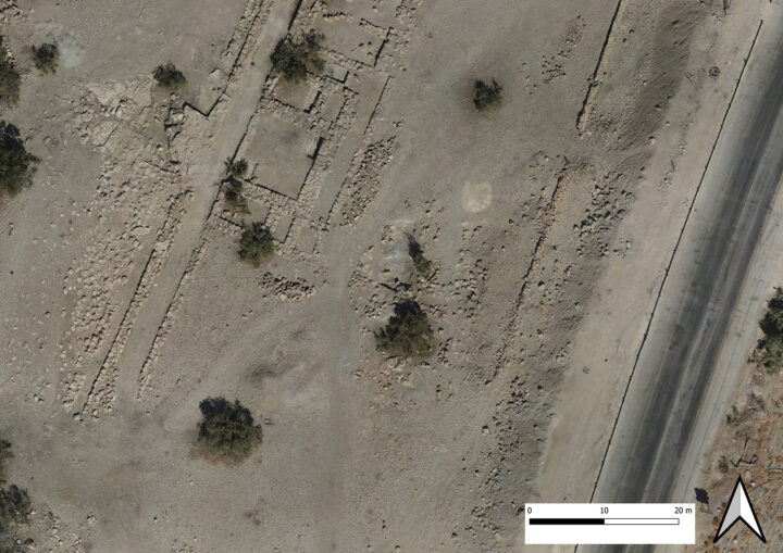
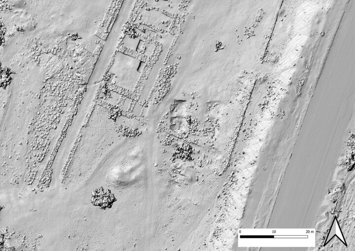
immediately visible on the normal orthophoto (see Fig. 2). (Data capture by Sager Drones; derivatives and maps produced by Matthew L. Vincent.)
Today, drones are one of the most useful tools archaeologists have, especially for mapping and documenting sites, and they are easily one of the most accessible elements in our remote-sensing toolbox. Their cost has dropped, their software has matured, and a competent operator can produce survey-grade outputs that would have needed a small team and a much bigger budget only little over a decade ago. But it goes well beyond the visual. Hyper- and multi-spectral imaging, easily mounted on a drone, can pull out features through vegetation, picking up crop marks and soil signatures that the human eye is incapable of registering. The normalized difference vegetation index (NDVI), which uses red and infrared spectra, and its various cousins have moved out of specialist remote-sensing labs and into the standard toolkit of any survey project willing to invest in a multi-spectral payload. And even with a standard RGB camera, the kind built into a consumer drone you can buy off the shelf, subtle changes show up in hillshades (models of simulated sunlight cast across an orthophoto at different angles) that we would otherwise miss completely (Fig. 3). Get a low sun angle, run a decent digital surface model, and suddenly a wall line that is invisible at ground level jumps out at you, stretching across an acre.
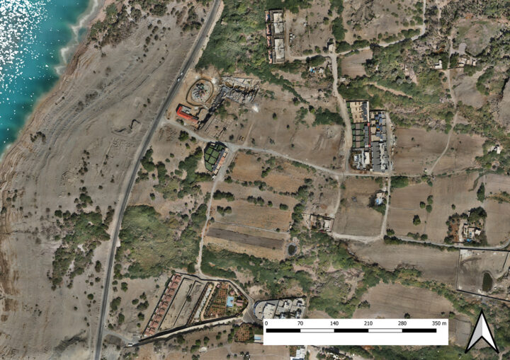
We have put all of this to work at the site of ‘Ain az-Zara—ancient Kallirhoe—thanks to a generous grant from the U.S. Embassy in Amman and the U.S. State Department’s Ambassadors Fund for Cultural Preservation. As part of the Preservation and Protection of the Holy Land at Herod’s Ain az-Zara Palace and Port to Mukawir project, we performed a full drone survey of the site itself plus a generous buffer of the surrounding landscape. Kallirhoe sits in a striking spot on the eastern shore of the Dead Sea, and any documentation work there has to deal with more than just the archaeology. We also must take into account the springs, the wadis, the modern construction encroaching on the site, and the ways the landscape keeps getting reshaped around the ancient remains. You cannot really understand a site like this with a tight crop around the visible architecture. You need the surroundings.
The numbers from the drone flight over Kallirhoe tell part of the story: a dataset comprising 4,319 images, a ground sampling distance (GSD, the value of each pixel in real-world size) of 1.5 cm or a little more than half an inch, covering an area of nearly 1,100 acres (4.4 km2). What that translates to in practice is a base map at a quality and resolution that just was not on the table for a project of this scale even a few years ago. From that one dataset, we generated an orthophoto, a digital surface model, and a digital elevation model (DEM). And then we started picking each of them apart.
The hillshade analysis surprised us. Running the DEM through a few different sun angles brought out features that were either invisible or barely detectable in the orthophoto of Kallirhoe: old field boundaries, the faint outlines of structures we had not cataloged, and, somewhat to our amusement, a clear record of where previous excavators had dumped their archaeological sediment in the 1980s. There is something amusing about a survey that documents not just the ancient site but also the modern history of working on it, too. Spoil heaps are part of the archaeological record now whether we like it or not, and the hillshade made them impossible to miss.
But a base map, however good, is useful only if the people working on the site can actually use it, in the field, on their own devices, without waiting for someone back at the dig house to process anything. So, we pulled the whole thing together into a free, open-source stack of software: PostGIS for the database backend, Mergin Maps for the field-side interface, and QGIS for the desktop work. The result is a mobile data collection system that runs on the Kallirhoe project staff’s phones and tablets, syncs in real time back to a central searchable geographic database (PostGIS instance), and (importantly) talks directly to our RTK GNSS receivers. A surveyor in the field can take a point accurate to a fraction of an inch, attach a structured record to it, photograph the feature, and have it in the project database before they have walked to the next find. There are no paper forms to transcribe later, no orphaned coordinates trying to find their parent record, no end-of-season pile of data entry waiting for someone to plow through.
The “open source” part of that is not incidental. Every component of the stack—PostGIS, Mergin Maps, QGIS—is software that the project owns the use of, in perpetuity. That means there is no license renewal hanging over our heads and no vendor decisions about changes to their software to worry about. For a regional project, or for our partners in heritage institutions across Jordan and the wider region, that matters a lot. The barrier to using this kind of workflow is no longer the price of the software. It is, instead, the time and expertise to set it up. And that is a barrier we can readily overcome.
This stack we have put together is still in its early days. It works, and it has already changed how we collect data at Kallirhoe, but I would be lying if I said we have figured it all out. Every season we run it, we find something else to refine: a data field that should have been a dropdown selection instead of a field to type in, a workflow step that made sense in the office but falls apart under the sun at 100 degrees Farenheit (38 Celsius), a bit of QGIS coding that needs to be smoother before we can hand it off to someone less GIS literate…. The plan is to keep revising until what we have is a full documentation system, not just a clever data-collection tool. We are not there yet, but we are closer than we were last season, and we will be closer again next season.
Another thing worth saying—and this is the part I think about most these days—is how fragile any of this is. Recent regional conflicts have made that uncomfortably clear. GPS jamming has become a real factor in this part of the world, and the moment a GNSS receiver cannot get a fix on a satellite, a huge chunk of the newly built workflow just stops working. Or the drone will not fly properly. Or the rover cannot log a point. Or the base station sits there doing nothing. All this beautiful infrastructure… and it falls over because of something happening hundreds of miles away that has nothing to do with us.
We can resort to the total station, and we sometimes have. It still works. It does not care what the satellites are doing. But it requires a whole different, less convenient, workflow. The data still get there in the end, but without the speed and the simplicity we have grown used to. It is a useful reminder that the tools we lean on the hardest are also the ones that we miss most when they go away.
During these challenging times, our fieldwork at Kallirhoe, funded by the U.S. Department of State with the permission of the Department of Antiquities, is yielding more than site maps, objects, and knowledge about this important site and its era. It is allowing us to contribute to the development of technological tools and techniques, and giving our staff experience and expertise, that will be useful elsewhere in Jordan far beyond the duration of the Cultural Preservation: Preservation and Protection of the Holy Land at Herod’s Ain az-Zara Palace and Port to Mukawir project.
To learn more about ‘Ain az-Zara/Kallirhoe and our work there, click here.
This essay was funded by a grant from the United States Department of State. The opinions, findings and conclusions stated herein are those of the authors and do not necessarily reflect those of the United States Department of State.
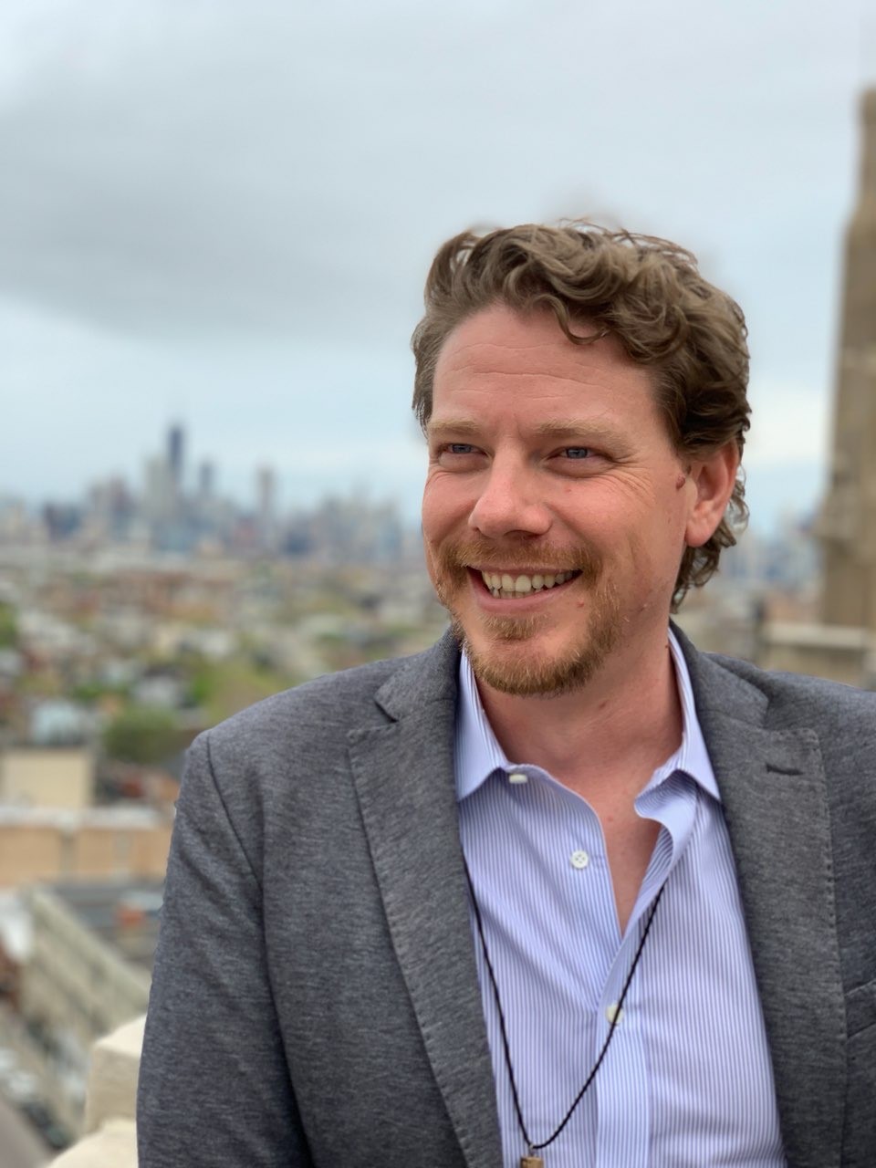
Matthew L. Vincent joined the American Center of Research in October 2022 as a project co-director for the National Inventory Project. He participates in many of ACOR’s projects, including “Preservation and Protection of the Holy Land at Herod’s Ain az-Zara Palace and Port to Mukawir.” Since his first season of work in Jordan at Tall al-’Umayri in 2004, Matthew has been looking for ways to combine technology and archaeology to improve accessibility of information and resources and to improve how we work. Matthew has worked on everything from in-field data collection to photogrammetry and terrestrial laser scanning to balloon and drone-based aerial photogrammetry. Cofounder of Rekrei (formerly known as Project Mosul), a crowd-sourcing platform for the preservation of lost heritage, Matthew is always interested in finding new ways that technology can serve cultural heritage, both for preserving our past for future generations and for advancing our ability to conduct research now. He is always looking at ways to broaden his experience in the area of digital cultural heritage and is excited to see how the field continues to progress.